 vesseltracker.com
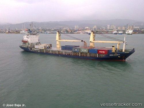
Ocean Serenity
Current StatusWhere is the vessel?
Ocean Serenity is currently in Near Iloilo, based on AIS data received about 20h ago.
Latest AIS update:
Current position: 10.68940° N, 122.58258° E (Near Iloilo)
Average speed (last 7 days): Loading…
Average speed (last 30 days): Loading…
Vessel profile: Ocean Serenity is a Multi Purpose Carrier with dimensions 16m x 98m.
This page combines live AIS, route history, probable destination signals, nearby traffic, and port activity for practical vessel monitoring.
The current position of vessel Ocean Serenity is 10.68940 lat / 122.58258 lng. Updated: 2026-04-07 05:53:09 UTCNearest reference points:
- Near Iloilo
- Near BACOLOD
- Near TOLEDO
Details:
Live Vessel Ocean Serenity Analytics (details, animations, etc.)
Recent AIS points (UTC):
2026-04-07 05:53:09 UTC · 10.68940, 122.58258 · SOG 0 kn · COG -1°2026-04-07 05:53:09 UTC · 10.68940, 122.58258 · SOG 0 kn · COG -1°
2026-04-07 05:53:09 UTC · 10.68940, 122.58258 · SOG 0 kn · COG -1°
2026-04-07 05:53:09 UTC · 10.68940, 122.58258 · SOG 0 kn · COG -1°