 vesseltracker.com
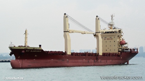
 DONA DANESSA ISOBEL
Current Status
Where is the vessel?
DONA DANESSA ISOBEL is currently in Near Bauan/Batangas, based on AIS data received about 6d ago.
Latest AIS update:
Current position: 13.78232° N, 120.98441° E (Near Bauan/Batangas)
Average speed (last 7 days): Loading…
Average speed (last 30 days): Loading…
Vessel profile: DONA DANESSA ISOBEL is a General Cargo with dimensions m x m.
This page combines live AIS, route history, probable destination signals, nearby traffic, and port activity for practical vessel monitoring.
The current position of vessel DONA DANESSA ISOBEL is 13.78232 lat / 120.98441 lng. Updated: 2026-04-16 02:50:41 UTCNearest reference points:
- Near Lobo
- 12 nm S of Lobo
- Near Nasugbu, Luzon
Currently sailing under the flag of Philippines ![]()
Details:
Live Vessel DONA DANESSA ISOBEL Analytics (details, animations, etc.)
Recent AIS points (UTC):
2026-04-16 02:50:41 UTC · 13.78232, 120.98441 · SOG 0 kn · COG -1°2026-04-16 02:50:41 UTC · 13.78232, 120.98441 · SOG 0 kn · COG -1°
2026-04-16 02:50:41 UTC · 13.78232, 120.98441 · SOG 0 kn · COG -1°