 vesseltracker.com
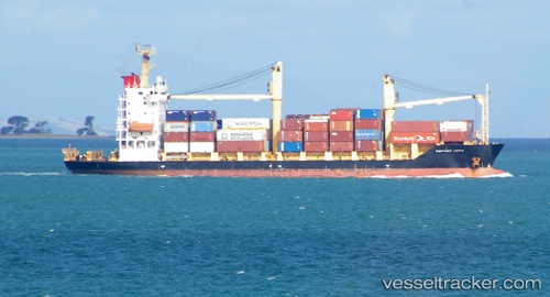
Gazelle Coast
Current StatusWhere is the vessel?
Gazelle Coast is currently in 30 nm W of Samarai, based on AIS data received less than 1h ago.
Latest AIS update:
Current position: 10.74167° S, 150.14333° E (30 nm W of Samarai)
Average speed (last 7 days): Loading…
Average speed (last 30 days): Loading…
Vessel profile: Gazelle Coast is a Container Ship with dimensions 20m x 116m.
This page combines live AIS, route history, probable destination signals, nearby traffic, and port activity for practical vessel monitoring.
The current position of vessel Gazelle Coast is -10.74167 lat / 150.14333 lng. Updated: 2026-04-06 12:11:49 UTCDetails:
Live Vessel Gazelle Coast Analytics (details, animations, etc.)
Recent AIS points (UTC):
2026-04-06 05:50:51 UTC · -10.57833, 149.16333 · SOG 8 kn · COG -1°2026-04-06 07:46:21 UTC · -10.64927, 149.45605 · SOG 9 kn · COG 105°
2026-04-06 09:52:06 UTC · -10.72827, 149.76950 · SOG 9.1 kn · COG 89°
2026-04-06 12:11:49 UTC · -10.74167, 150.14333 · SOG 9 kn · COG -1°