 vesseltracker.com
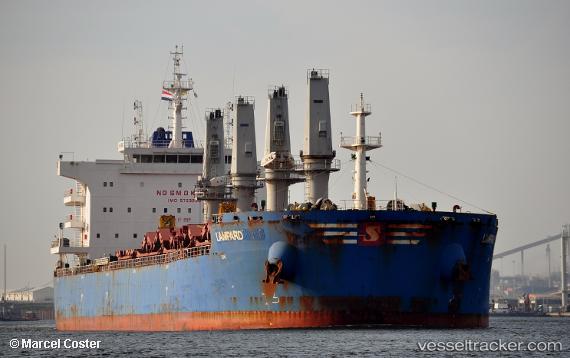
Lampard
Current StatusWhere is the vessel?
Lampard is currently in Near Ingeniero Buitrago, based on AIS data received about 1h ago.
Latest AIS update:
Current position: 33.34928° S, 60.17817° W (Near Ingeniero Buitrago)
Average speed (last 7 days): Loading…
Average speed (last 30 days): Loading…
Vessel profile: Lampard is a Bulk Carrier with dimensions 32m x 200m.
This page combines live AIS, route history, probable destination signals, nearby traffic, and port activity for practical vessel monitoring.
The current position of vessel Lampard is -33.34928 lat / -60.17817 lng. Updated: 2026-04-06 15:15:42 UTCNearest reference points:
- 10 nm NW of San Pedro
- Near Quebracho/San Lorenzo
- Near Puerto Alumbrera
Details:
Live Vessel Lampard Analytics (details, animations, etc.)
Recent AIS points (UTC):
2026-04-06 09:27:37 UTC · -33.34926, -60.17814 · SOG 0 kn · COG 306°2026-04-06 11:48:39 UTC · -33.34930, -60.17816 · SOG 0 kn · COG 306°
2026-04-06 14:06:37 UTC · -33.34927, -60.17818 · SOG 0 kn · COG 306°
2026-04-06 15:15:42 UTC · -33.34928, -60.17817 · SOG 0 kn · COG 306°