 vesseltracker.com
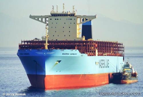
Maersk Hamburg
Current StatusWhere is the vessel?
Maersk Hamburg is currently in 294 nm SW of Keti Bandar, based on AIS data received about 1d ago.
Latest AIS update:
Current position: 20.25435° N, 64.19837° E (294 nm SW of Keti Bandar)
Average speed (last 7 days): Loading…
Average speed (last 30 days): Loading…
Vessel profile: Maersk Hamburg is a Container Ship with dimensions 54m x 353m.
This page combines live AIS, route history, probable destination signals, nearby traffic, and port activity for practical vessel monitoring.
The current position of vessel Maersk Hamburg is 20.25435 lat / 64.19837 lng. Updated: 2026-04-10 07:36:16 UTCNearest reference points:
- 262 nm SE of SUR
- 231 nm SW of Keti Bandar
- 224 nm E of SUR
Details:
Live Vessel Maersk Hamburg Analytics (details, animations, etc.)
Recent AIS points (UTC):
2026-04-10 01:56:24 UTC · 19.87423, 63.18003 · SOG 11.1 kn · COG 71°2026-04-10 03:40:36 UTC · 19.98728, 63.49097 · SOG 10.8 kn · COG 67°
2026-04-10 06:08:54 UTC · 20.15143, 63.93320 · SOG 10.8 kn · COG 63°
2026-04-10 07:36:16 UTC · 20.25435, 64.19837 · SOG 11.2 kn · COG 66°