 vesseltracker.com
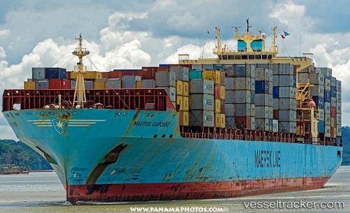
 Maersk Garonne
Current Status
Where is the vessel?
Maersk Garonne is currently in 96 nm N of Munshiganj, based on AIS data received about 1h ago.
Latest AIS update:
Current position: 25.14143° N, 90.60475° W (96 nm N of Munshiganj)
Average speed (last 7 days): Loading…
Average speed (last 30 days): Loading…
Vessel profile: Maersk Garonne is a Container Ship with dimensions 292m x 292m.
This page combines live AIS, route history, probable destination signals, nearby traffic, and port activity for practical vessel monitoring.
The current position of vessel Maersk Garonne is 25.14143 lat / -90.60475 lng. Updated: 2026-04-18 06:56:06 UTCNearest reference points:
- 94 nm S of Gulfmex Lightering Area
- 124 nm SW of Gulfmex Lightering Area
Currently sailing under the flag of Singapore ![]()
Maersk Garonne built in 2003 year
Deadweight:
61636 tDetails:
Live Vessel Maersk Garonne Analytics (details, animations, etc.)
Recent AIS points (UTC):
2026-04-18 02:18:49 UTC · 25.50110, -91.97103 · SOG 17.2 kn · COG 128°2026-04-18 03:42:13 UTC · 25.35758, -91.56711 · SOG 16.8 kn · COG 114°
2026-04-18 05:36:05 UTC · 25.22496, -91.00199 · SOG 16.7 kn · COG -1°
2026-04-18 06:56:06 UTC · 25.14143, -90.60475 · SOG 16.5 kn · COG 105°