 vesseltracker.com
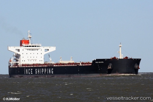
Ince Ankara
Current StatusWhere is the vessel?
Ince Ankara is currently in 19 nm E of Ryuo, based on AIS data received about 1h ago.
Latest AIS update:
Current position: 35.73418° N, 16.98833° E (19 nm E of Ryuo)
Average speed (last 7 days): Loading…
Average speed (last 30 days): Loading…
Vessel profile: Ince Ankara is a Bulk Carrier with dimensions 43m x 253m.
This page combines live AIS, route history, probable destination signals, nearby traffic, and port activity for practical vessel monitoring.
The current position of vessel Ince Ankara is 35.73418 lat / 16.98833 lng. Updated: 2026-04-08 13:59:44 UTCNearest reference points:
- 53 nm NE of Ryuo
- 33 nm N of Ryuo
- 64 nm NE of Ryuo
Details:
Live Vessel Ince Ankara Analytics (details, animations, etc.)
Recent AIS points (UTC):
2026-04-08 08:01:21 UTC · 35.96626, 15.62162 · SOG 11.9 kn · COG 101°2026-04-08 09:55:56 UTC · 35.89623, 16.06551 · SOG 11.1 kn · COG 103°
2026-04-08 11:57:54 UTC · 35.81142, 16.52840 · SOG 11.3 kn · COG 101°
2026-04-08 13:59:44 UTC · 35.73418, 16.98833 · SOG 11 kn · COG 101°