 vesseltracker.com
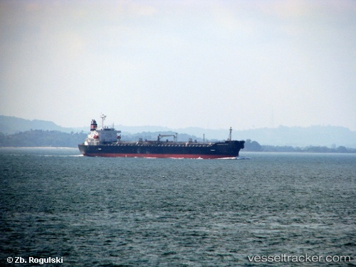
 CHEM GUARD
Current Status
Where is the vessel?
CHEM GUARD is currently in 10 nm W of Chengxi, based on AIS data received about 1h ago.
Latest AIS update:
Current position: 31.95798° N, 120.03656° E (10 nm W of Chengxi)
Average speed (last 7 days): Loading…
Average speed (last 30 days): Loading…
Vessel profile: CHEM GUARD is a Oil/Chemical Tanker with dimensions m x m.
This page combines live AIS, route history, probable destination signals, nearby traffic, and port activity for practical vessel monitoring.
The current position of vessel CHEM GUARD is 31.95798 lat / 120.03656 lng. Updated: 2026-04-04 04:07:37 UTCNearest reference points:
- Near Chengxi
- Near Taixing
- Near Changzhou Pt
Currently sailing under the flag of Singapore ![]()
Details:
Live Vessel CHEM GUARD Analytics (details, animations, etc.)
Recent AIS points (UTC):
2026-04-03 21:34:39 UTC · 31.95785, 120.03655 · SOG 0 kn · COG 293°2026-04-03 23:35:19 UTC · 31.95783, 120.03660 · SOG 0 kn · COG 293°
2026-04-04 01:40:40 UTC · 31.95793, 120.03657 · SOG 0 kn · COG 293°
2026-04-04 04:07:37 UTC · 31.95798, 120.03656 · SOG 0 kn · COG 293°