 vesseltracker.com
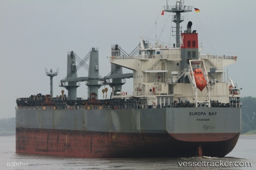
 EUROPA BAY
Current Status
Where is the vessel?
EUROPA BAY is currently in 48 nm SW of Acapulco, based on AIS data received about 2h ago.
Latest AIS update:
Current position: 16.23333° N, 100.46333° W (48 nm SW of Acapulco)
Average speed (last 7 days): Loading…
Average speed (last 30 days): Loading…
Vessel profile: EUROPA BAY is a Cargo with dimensions m x m.
This page combines live AIS, route history, probable destination signals, nearby traffic, and port activity for practical vessel monitoring.
The current position of vessel EUROPA BAY is 16.23333 lat / -100.46333 lng. Updated: 2026-04-19 13:53:01 UTCNearest reference points:
- Near Acapulco
- Near Ixtapa/Zihuatanejo
- Near Lazaro Cardenas
Currently sailing under the flag of Singapore ![]()
Details:
Live Vessel EUROPA BAY Analytics (details, animations, etc.)
Recent AIS points (UTC):
2026-04-19 10:40:58 UTC · 16.62500, -100.99166 · SOG 12 kn · COG -1°2026-04-19 11:45:20 UTC · 16.49108, -100.81720 · SOG 11.7 kn · COG 129°
2026-04-19 13:20:01 UTC · 16.29667, -100.55667 · SOG 11 kn · COG -1°
2026-04-19 13:53:01 UTC · 16.23333, -100.46333 · SOG 12 kn · COG -1°