 vesseltracker.com
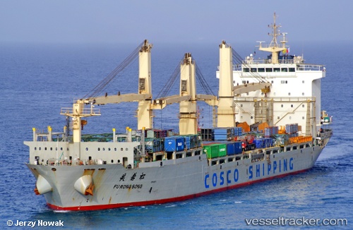
 FU RONG SONG
Current Status
Where is the vessel?
FU RONG SONG is currently in 31 nm W of Gibraltar, based on AIS data received about 12h ago.
Latest AIS update:
Current position: 36.25265° N, 6.98180° W (31 nm W of Gibraltar)
Average speed (last 7 days): Loading…
Average speed (last 30 days): Loading…
Vessel profile: FU RONG SONG is a Cargo with dimensions m x m.
This page combines live AIS, route history, probable destination signals, nearby traffic, and port activity for practical vessel monitoring.
The current position of vessel FU RONG SONG is 36.25265 lat / -6.98180 lng. Updated: 2026-04-10 07:27:05 UTCNearest reference points:
- 45 nm W of Gibraltar
- Near Gibraltar
- Near CHIPIONA
Currently sailing under the flag of Singapore ![]()
Details:
Live Vessel FU RONG SONG Analytics (details, animations, etc.)
Recent AIS points (UTC):
2026-04-10 02:37:05 UTC · 36.27833, -7.05167 · SOG 0 kn · COG -1°2026-04-10 04:17:27 UTC · 36.26955, -7.03063 · SOG 0.8 kn · COG -1°
2026-04-10 05:23:57 UTC · 36.26420, -7.01506 · SOG 0.9 kn · COG 201°
2026-04-10 07:27:05 UTC · 36.25265, -6.98180 · SOG 0.7 kn · COG 222°