 vesseltracker.com
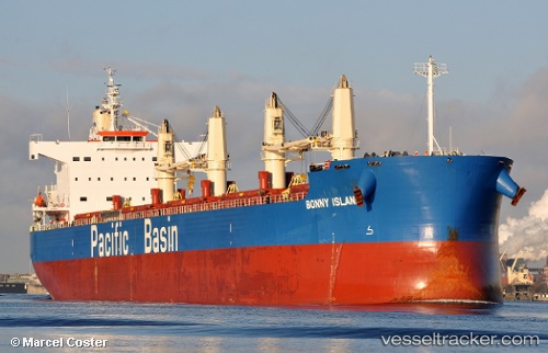
 BONNY ISLAND
Current Status
Where is the vessel?
BONNY ISLAND is currently in Near Kitimat, based on AIS data received about 2h ago.
Latest AIS update:
Current position: 53.99531° N, 128.69196° W (Near Kitimat)
Average speed (last 7 days): Loading…
Average speed (last 30 days): Loading…
Vessel profile: BONNY ISLAND is a Bulk Carrier with dimensions m x m.
This page combines live AIS, route history, probable destination signals, nearby traffic, and port activity for practical vessel monitoring.
The current position of vessel BONNY ISLAND is 53.99531 lat / -128.69196 lng. Updated: 2026-03-31 07:23:23 UTCNearest reference points:
- Near Kitimat
- 11 nm S of Kitimat
- 39 nm S of Butedale
Currently sailing under the flag of Singapore ![]()
Details:
Live Vessel BONNY ISLAND Analytics (details, animations, etc.)
Recent AIS points (UTC):
2026-03-31 01:31:57 UTC · 53.99696, -128.69295 · SOG 0 kn · COG 354°2026-03-31 04:19:51 UTC · 53.99697, -128.69295 · SOG 0 kn · COG 354°
2026-03-31 05:55:54 UTC · 53.99701, -128.69293 · SOG 0 kn · COG 354°
2026-03-31 07:23:23 UTC · 53.99531, -128.69196 · SOG 0.7 kn · COG 355°