 vesseltracker.com
 CHATHAM ISLAND
Current Status
Where is the vessel?
CHATHAM ISLAND is currently in 83 nm W of Sandys, based on AIS data received about 1h ago.
Latest AIS update:
Current position: 32.10675° N, 66.47507° W (83 nm W of Sandys)
Average speed (last 7 days): Loading…
Average speed (last 30 days): Loading…
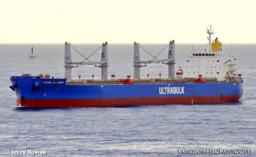
Vessel profile: CHATHAM ISLAND is a Bulk Carrier with dimensions m x m.
This page combines live AIS, route history, probable destination signals, nearby traffic, and port activity for practical vessel monitoring.
The current position of vessel CHATHAM ISLAND is 32.10675 lat / -66.47507 lng. Updated: 2026-03-29 12:13:56 UTCNearest reference points:
- 160 nm W of Sandys
Currently sailing under the flag of Singapore ![]()
Details:
Live Vessel CHATHAM ISLAND Analytics (details, animations, etc.)
Recent AIS points (UTC):
2026-03-29 05:19:05 UTC · 31.71593, -67.49567 · SOG 8.7 kn · COG 62°2026-03-29 07:45:15 UTC · 31.85674, -67.11786 · SOG 8.4 kn · COG 62°
2026-03-29 09:41:04 UTC · 31.96501, -66.84797 · SOG 8.6 kn · COG 62°
2026-03-29 12:13:56 UTC · 32.10675, -66.47507 · SOG 8 kn · COG 61°