 vesseltracker.com
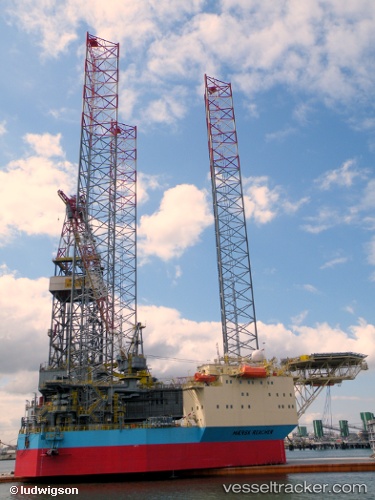
 Maersk Reacher
Current Status
Where is the vessel?
Maersk Reacher is currently in 19 nm SW of Claonaig, based on AIS data received about 940d ago.
Latest AIS update:
Current position: 55.48034° N, 5.10750° E (19 nm SW of Claonaig)
Average speed (last 7 days): Loading…
Average speed (last 30 days): Loading…
Vessel profile: Maersk Reacher is a Service Ship with dimensions 103m x 68m.
This page combines live AIS, route history, probable destination signals, nearby traffic, and port activity for practical vessel monitoring.
The current position of vessel Maersk Reacher is 55.48034 lat / 5.10750 lng. Updated: 2023-09-12 12:15:01 UTCNearest reference points:
- 14 nm NW of Town Quays/Drogheda
- 36 nm W of HVIDE SANDE
- 26 nm W of Cleghorn
Currently sailing under the flag of Singapore ![]()
Maersk Reacher built in 2009 year
Deadweight:
5018 tDetails:
Live Vessel Maersk Reacher Analytics (details, animations, etc.)
Recent AIS points (UTC):
2023-09-12 12:15:01 UTC · 55.48034, 5.10750 · SOG 0 kn · COG -1°