 vesseltracker.com
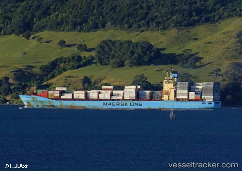
 Maersk Bratan
Current Status
Where is the vessel?
Maersk Bratan is currently in 24 nm NE of Whangaroa, based on AIS data received about 1h ago.
Latest AIS update:
Current position: 34.68739° S, 174.00897° E (24 nm NE of Whangaroa)
Average speed (last 7 days): Loading…
Average speed (last 30 days): Loading…
Vessel profile: Maersk Bratan is a Container Ship with dimensions 223m x 32m.
This page combines live AIS, route history, probable destination signals, nearby traffic, and port activity for practical vessel monitoring.
The current position of vessel Maersk Bratan is -34.68739 lat / 174.00897 lng. Updated: 2026-04-10 07:40:53 UTCNearest reference points:
- 30 nm N of Waitangi
- Near Waitangi
- 10 nm NE of Russel
Currently sailing under the flag of Singapore ![]()
Maersk Bratan built in 2009 year
Deadweight:
43114 tDetails:
Live Vessel Maersk Bratan Analytics (details, animations, etc.)
Recent AIS points (UTC):
2026-04-10 01:48:11 UTC · -35.45360, 175.14613 · SOG 12.6 kn · COG 320°2026-04-10 04:06:57 UTC · -35.11277, 174.75481 · SOG 12.4 kn · COG 304°
2026-04-10 05:43:27 UTC · -34.92302, 174.41359 · SOG 12.5 kn · COG 308°
2026-04-10 07:40:53 UTC · -34.68739, 174.00897 · SOG 12.3 kn · COG 303°