 vesseltracker.com
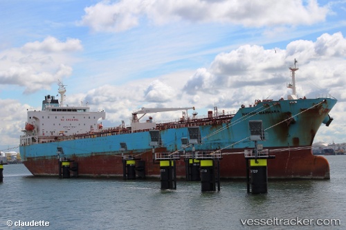
 Maersk Marmara
Current Status
Where is the vessel?
Maersk Marmara is currently in Near Santos, based on AIS data received about 13h ago.
Latest AIS update:
Current position: 23.92560° S, 46.32846° W (Near Santos)
Average speed (last 7 days): Loading…
Average speed (last 30 days): Loading…
Vessel profile: Maersk Marmara is a Chemical Oil Products Tanker with dimensions 183m x 32m.
This page combines live AIS, route history, probable destination signals, nearby traffic, and port activity for practical vessel monitoring.
The current position of vessel Maersk Marmara is -23.92560 lat / -46.32846 lng. Updated: 2026-04-10 07:49:29 UTCNearest reference points:
- Near Santos
- Near Guarujá
- 30 nm SE of Guarujá
Currently sailing under the flag of Singapore ![]()
Maersk Marmara built in 2006 year
Deadweight:
51182 tDetails:
Live Vessel Maersk Marmara Analytics (details, animations, etc.)
Recent AIS points (UTC):
2026-04-10 02:03:52 UTC · -23.92556, -46.32843 · SOG 0 kn · COG 297°2026-04-10 03:26:27 UTC · -23.92560, -46.32846 · SOG 0 kn · COG 297°
2026-04-10 06:11:53 UTC · -23.92559, -46.32843 · SOG 0 kn · COG 297°
2026-04-10 07:49:29 UTC · -23.92560, -46.32846 · SOG 0 kn · COG 297°