 vesseltracker.com
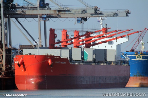
Santa Maria
Current StatusWhere is the vessel?
Santa Maria is currently in Near HULUDAO, based on AIS data received about 2h ago.
Latest AIS update:
Current position: 40.80920° N, 121.05669° E (Near HULUDAO)
Average speed (last 7 days): Loading…
Average speed (last 30 days): Loading…
Vessel profile: Santa Maria is a Bulk Carrier with dimensions 32m x 199m.
This page combines live AIS, route history, probable destination signals, nearby traffic, and port activity for practical vessel monitoring.
The current position of vessel Santa Maria is 40.80920 lat / 121.05669 lng. Updated: 2026-04-19 19:28:22 UTCNearest reference points:
- Near HULUDAO
- 18 nm SE of HULUDAO
- 20 nm S of HULUDAO
Details:
Live Vessel Santa Maria Analytics (details, animations, etc.)
Recent AIS points (UTC):
2026-04-19 16:07:24 UTC · 40.80920, 121.05670 · SOG 0 kn · COG 243°2026-04-19 17:49:21 UTC · 40.80921, 121.05669 · SOG 0 kn · COG 243°
2026-04-19 19:13:22 UTC · 40.80924, 121.05670 · SOG 0 kn · COG 243°
2026-04-19 19:28:22 UTC · 40.80920, 121.05669 · SOG 0 kn · COG 243°