 vesseltracker.com
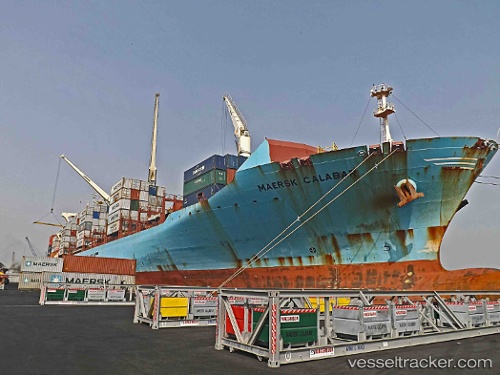
Maersk Calabar
Current StatusWhere is the vessel?
Maersk Calabar is currently in 248 nm E of Richards Bay, based on AIS data received less than 1h ago.
Latest AIS update:
Current position: 30.26245° S, 36.58845° E (248 nm E of Richards Bay)
Average speed (last 7 days): Loading…
Average speed (last 30 days): Loading…
Vessel profile: Maersk Calabar is a Container Ship with dimensions 37m x 249m.
This page combines live AIS, route history, probable destination signals, nearby traffic, and port activity for practical vessel monitoring.
The current position of vessel Maersk Calabar is -30.26245 lat / 36.58845 lng. Updated: 2026-04-17 03:47:19 UTCNearest reference points:
- 163 nm SE of Richards Bay
- 358 nm E of Richards Bay
- Open sea, approx. 403 nm off the nearest listed port
Details:
Live Vessel Maersk Calabar Analytics (details, animations, etc.)
Recent AIS points (UTC):
2026-04-16 22:21:49 UTC · -30.88808, 35.00025 · SOG 16.5 kn · COG 58°2026-04-17 00:18:43 UTC · -30.67230, 35.55267 · SOG 16.1 kn · COG 60°
2026-04-17 02:38:54 UTC · -30.39900, 36.24677 · SOG 17 kn · COG 63°
2026-04-17 03:47:19 UTC · -30.26245, 36.58845 · SOG 16.9 kn · COG 65°