 vesseltracker.com
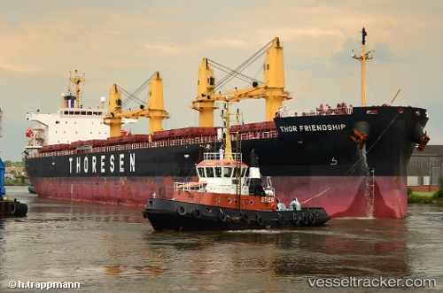
Thor Friendship
Current StatusWhere is the vessel?
Thor Friendship is currently in Near Sheppard, based on AIS data received about 1d ago.
Latest AIS update:
Current position: 29.20039° N, 94.68186° W (Near Sheppard)
Average speed (last 7 days): Loading…
Average speed (last 30 days): Loading…
Vessel profile: Thor Friendship is a Bulk Carrier with dimensions 32m x 190m.
This page combines live AIS, route history, probable destination signals, nearby traffic, and port activity for practical vessel monitoring.
The current position of vessel Thor Friendship is 29.20039 lat / -94.68186 lng. Updated: 2026-04-10 07:59:05 UTCNearest reference points:
- 12 nm SE of Port Bolivar
- Near Port Bolivar
- Near Texas City
Details:
Live Vessel Thor Friendship Analytics (details, animations, etc.)
Recent AIS points (UTC):
2026-04-10 02:38:05 UTC · 29.20051, -94.68184 · SOG 0.2 kn · COG 84°2026-04-10 04:23:12 UTC · 29.20046, -94.68189 · SOG 0.1 kn · COG 81°
2026-04-10 05:26:05 UTC · 29.20035, -94.68182 · SOG 0.1 kn · COG 77°
2026-04-10 07:59:05 UTC · 29.20039, -94.68186 · SOG 0.1 kn · COG 79°