 vesseltracker.com
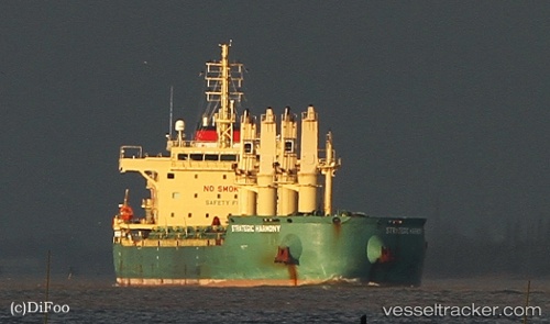
Vessel Strategic Harmony IMO: 9689897, MMSI: 565285000 Bulk Carrier
UTC, 31.21812, 33.85055, course: 300, speed: 0.2
UTC, 31.21808, 33.85054, course: 301, speed: 0.2
2026-02-14 19:47:10 UTC, 31.21864, 33.85041, course: 276, speed: 0.2
Live AIS position:
UTC. Near AL ARISH),
updated 2026-02-14 19:47:10 UTC.
Find the position of the vessel Strategic Harmony on the map. The latter are known coordinates and path.
marine traffic ship tracker show on live map
The current position of vessel Strategic Harmony is 31.21864 lat / 33.85041 lng. Updated: 2026-02-14 19:47:10 UTCDetails:
Last coordinates of the vessel:
UTC, 31.21837, 33.85075, course: 292, speed: 0.2UTC, 31.21812, 33.85055, course: 300, speed: 0.2
UTC, 31.21808, 33.85054, course: 301, speed: 0.2
2026-02-14 19:47:10 UTC, 31.21864, 33.85041, course: 276, speed: 0.2