 vesseltracker.com
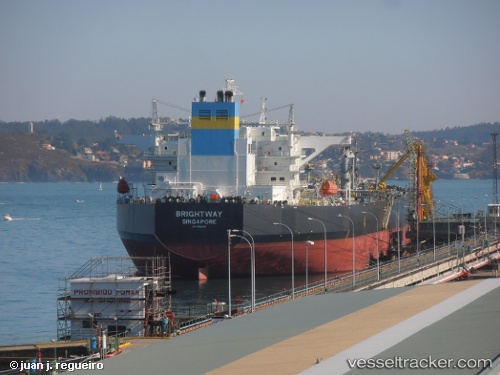
Brightway
Current StatusWhere is the vessel?
Brightway is currently in Near Flushing, based on AIS data received about 128d ago.
Latest AIS update:
Current position: 50.10870° N, 5.05069° W (Near Flushing)
Average speed (last 7 days): Loading…
Average speed (last 30 days): Loading…
Vessel profile: Brightway is a Crude Oil Tanker with dimensions 48m x 274m.
This page combines live AIS, route history, probable destination signals, nearby traffic, and port activity for practical vessel monitoring.
The current position of vessel Brightway is 50.10870 lat / -5.05069 lng. Updated: 2025-12-03 08:34:33 UTCNearest reference points:
- Near Flushing
- Near Falmouth
- Near Cadgwith
Details:
Live Vessel Brightway Analytics (details, animations, etc.)
Recent AIS points (UTC):
2025-12-03 08:34:33 UTC · 50.10870, -5.05069 · SOG 0.1 kn · COG 133°