 vesseltracker.com
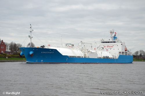
Kingcraft
Current StatusWhere is the vessel?
Kingcraft is currently in Near Pulau Indah, based on AIS data received about 1h ago.
Latest AIS update:
Current position: 2.79854° N, 101.30176° E (Near Pulau Indah)
Average speed (last 7 days): Loading…
Average speed (last 30 days): Loading…
Vessel profile: Kingcraft is a Lpg Tanker with dimensions 21m x 120m.
This page combines live AIS, route history, probable destination signals, nearby traffic, and port activity for practical vessel monitoring.
The current position of vessel Kingcraft is 2.79854 lat / 101.30176 lng. Updated: 2026-04-07 18:06:19 UTCNearest reference points:
- Near Pulau Indah
- Near Carey Island Estate
- Near Banting
Details:
Live Vessel Kingcraft Analytics (details, animations, etc.)
Recent AIS points (UTC):
2026-04-07 12:26:31 UTC · 2.56023, 101.50745 · SOG 11.9 kn · COG 308°2026-04-07 13:33:52 UTC · 2.68491, 101.32823 · SOG 11.5 kn · COG 299°
2026-04-07 15:32:19 UTC · 2.79730, 101.30384 · SOG 0 kn · COG -1°
2026-04-07 18:06:19 UTC · 2.79854, 101.30176 · SOG 0.1 kn · COG 159°