 vesseltracker.com
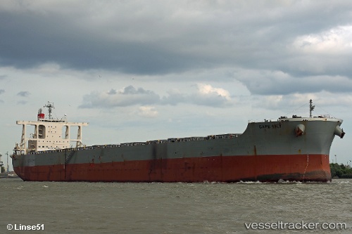
 Cape Lily
Current Status
Where is the vessel?
Cape Lily is currently in 239 nm NE of Gigmoto, Catanduanes, based on AIS data received about 5h ago.
Latest AIS update:
Current position: 15.58297° N, 128.04886° E (239 nm NE of Gigmoto, Catanduanes)
Average speed (last 7 days): Loading…
Average speed (last 30 days): Loading…
Vessel profile: Cape Lily is a Bulk Carrier with dimensions 292m x 45m.
This page combines live AIS, route history, probable destination signals, nearby traffic, and port activity for practical vessel monitoring.
The current position of vessel Cape Lily is 15.58297 lat / 128.04886 lng. Updated: 2026-04-05 10:02:24 UTCNearest reference points:
- 281 nm E of Gigmoto, Catanduanes
- Open sea, approx. 401 nm off the nearest listed port
- Open sea, approx. 402 nm off the nearest listed port
Currently sailing under the flag of Singapore ![]()
Details:
Live Vessel Cape Lily Analytics (details, animations, etc.)
Recent AIS points (UTC):
2026-04-05 04:33:13 UTC · 14.58792, 127.62589 · SOG 11.8 kn · COG 24°2026-04-05 04:33:13 UTC · 14.58792, 127.62589 · SOG 11.8 kn · COG 24°
2026-04-05 07:19:45 UTC · 15.10941, 127.82880 · SOG 11.9 kn · COG 28°
2026-04-05 10:02:24 UTC · 15.58297, 128.04886 · SOG 11.5 kn · COG 20°