 vesseltracker.com
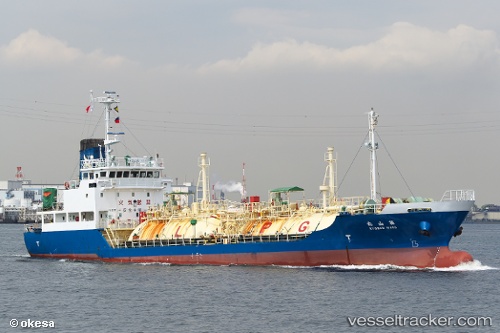
Pilatus 54
Current StatusWhere is the vessel?
Pilatus 54 is currently in Near Map Ta Phut, based on AIS data received less than 1h ago.
Latest AIS update:
Current position: 12.66944° N, 101.15042° E (Near Map Ta Phut)
Average speed (last 7 days): Loading…
Average speed (last 30 days): Loading…
Vessel profile: Pilatus 54 is a Lpg Tanker with dimensions 11m x 65m.
This page combines live AIS, route history, probable destination signals, nearby traffic, and port activity for practical vessel monitoring.
The current position of vessel Pilatus 54 is 12.66944 lat / 101.15042 lng. Updated: 2026-04-22 04:23:15 UTCNearest reference points:
- 11 nm S of Map Ta Phut
- Near SATTAHIP
- Near Tips Container Terminal
Details:
Live Vessel Pilatus 54 Analytics (details, animations, etc.)
Recent AIS points (UTC):
2026-04-22 01:34:06 UTC · 12.66853, 101.14858 · SOG 2.9 kn · COG 72°2026-04-22 01:56:12 UTC · 12.66946, 101.15042 · SOG 0 kn · COG 275°
2026-04-22 04:17:14 UTC · 12.66943, 101.15041 · SOG 0 kn · COG 275°
2026-04-22 04:23:15 UTC · 12.66944, 101.15042 · SOG 0 kn · COG 275°