 vesseltracker.com
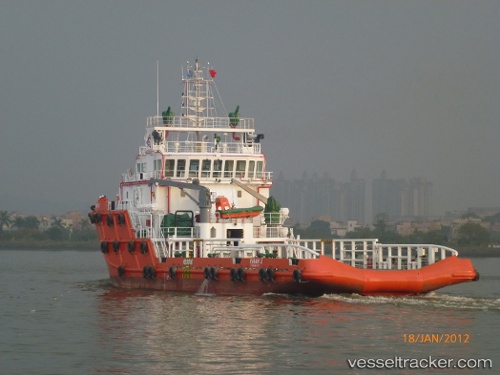
Rawabi 2
Current StatusWhere is the vessel?
Rawabi 2 is currently in 28 nm NE of Bandar Al Mishab, based on AIS data received less than 1h ago.
Latest AIS update:
Current position: 28.40340° N, 49.16132° E (28 nm NE of Bandar Al Mishab)
Average speed (last 7 days): Loading…
Average speed (last 30 days): Loading…
Vessel profile: Rawabi 2 is a Offshore Tug Supply Ship with dimensions 15m x 60m.
This page combines live AIS, route history, probable destination signals, nearby traffic, and port activity for practical vessel monitoring.
The current position of vessel Rawabi 2 is 28.40340 lat / 49.16132 lng. Updated: 2026-04-08 11:45:39 UTCNearest reference points:
- 26 nm E of Bandar Al Mishab
- 29 nm E of Bandar Al Mishab
- 31 nm S of Soroosh (Cyrus) Terminal
Details:
Live Vessel Rawabi 2 Analytics (details, animations, etc.)
Recent AIS points (UTC):
2026-04-08 06:23:34 UTC · 28.40369, 49.15911 · SOG 0 kn · COG 330°2026-04-08 07:44:47 UTC · 28.40366, 49.15919 · SOG 0 kn · COG -1°
2026-04-08 09:52:15 UTC · 28.40367, 49.15916 · SOG 0 kn · COG 334°
2026-04-08 11:45:39 UTC · 28.40340, 49.16132 · SOG 0.2 kn · COG -1°