 vesseltracker.com
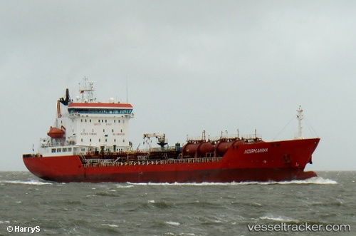
 NORMAN
Current Status
Where is the vessel?
NORMAN is currently in 14 nm SW of Wadi Feiran, based on AIS data received about 1h ago.
Latest AIS update:
Current position: 28.63935° N, 32.97315° E (14 nm SW of Wadi Feiran)
Average speed (last 7 days): Loading…
Average speed (last 30 days): Loading…
Vessel profile: NORMAN is a Oil/Chemical Tanker with dimensions m x m.
This page combines live AIS, route history, probable destination signals, nearby traffic, and port activity for practical vessel monitoring.
The current position of vessel NORMAN is 28.63935 lat / 32.97315 lng. Updated: 2026-04-19 01:44:40 UTCNearest reference points:
- Near Ras Gharib
- Near Ras Sudr
- Near Al Adabiyah
Currently sailing under the flag of Tuvalu ![]()
Details:
Live Vessel NORMAN Analytics (details, animations, etc.)
Recent AIS points (UTC):
2026-04-18 19:54:31 UTC · 29.07598, 32.76159 · SOG 4.3 kn · COG 162°2026-04-18 22:14:41 UTC · 28.90111, 32.83400 · SOG 5.1 kn · COG 165°
2026-04-18 23:29:40 UTC · 28.80330, 32.87592 · SOG 4.8 kn · COG 164°
2026-04-19 01:44:40 UTC · 28.63935, 32.97315 · SOG 4.6 kn · COG 150°