 vesseltracker.com
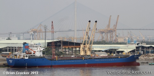
Truongloc16
Current StatusWhere is the vessel?
Truongloc16 is currently in Near Nha Be, based on AIS data received less than 1h ago.
Latest AIS update:
Current position: 10.71482° N, 106.75123° E (Near Nha Be)
Average speed (last 7 days): Loading…
Average speed (last 30 days): Loading…
Vessel profile: Truongloc16 is a General Cargo Ship with dimensions 16m x 92m.
This page combines live AIS, route history, probable destination signals, nearby traffic, and port activity for practical vessel monitoring.
The current position of vessel Truongloc16 is 10.71482 lat / 106.75123 lng. Updated: 2026-04-20 15:33:09 UTCNearest reference points:
- Near Nha Be
- Near Cat Lai Oil Port
- Near Saigon Petro Oil Terminal
Details:
Live Vessel Truongloc16 Analytics (details, animations, etc.)
Recent AIS points (UTC):
2026-04-20 12:26:19 UTC · 10.71471, 106.75154 · SOG 0.4 kn · COG 202°2026-04-20 13:25:25 UTC · 10.71466, 106.75158 · SOG 0 kn · COG 202°
2026-04-20 14:12:00 UTC · 10.71482, 106.75124 · SOG 0 kn · COG 202°
2026-04-20 15:33:09 UTC · 10.71482, 106.75123 · SOG 0.1 kn · COG 202°