 vesseltracker.com
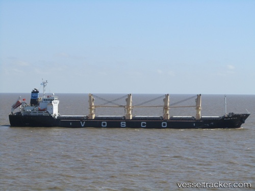
Blue Star
Current StatusWhere is the vessel?
Blue Star is currently in Near Taixing, based on AIS data received about 15h ago.
Latest AIS update:
Current position: 32.03788° N, 119.93336° E (Near Taixing)
Average speed (last 7 days): Loading…
Average speed (last 30 days): Loading…
Vessel profile: Blue Star is a Bulk Carrier with dimensions 26m x 153m.
This page combines live AIS, route history, probable destination signals, nearby traffic, and port activity for practical vessel monitoring.
The current position of vessel Blue Star is 32.03788 lat / 119.93336 lng. Updated: 2026-04-10 07:54:33 UTCNearest reference points:
- Near Taixing
- Near Yangzhong
- Near Chengxi
Details:
Live Vessel Blue Star Analytics (details, animations, etc.)
Recent AIS points (UTC):
2026-04-10 01:36:17 UTC · 32.03788, 119.93342 · SOG 0 kn · COG -1°2026-04-10 04:10:05 UTC · 32.03793, 119.93340 · SOG 0 kn · COG 338°
2026-04-10 05:43:29 UTC · 32.03792, 119.93335 · SOG 0 kn · COG -1°
2026-04-10 07:54:33 UTC · 32.03788, 119.93336 · SOG 0 kn · COG 338°