 vesseltracker.com
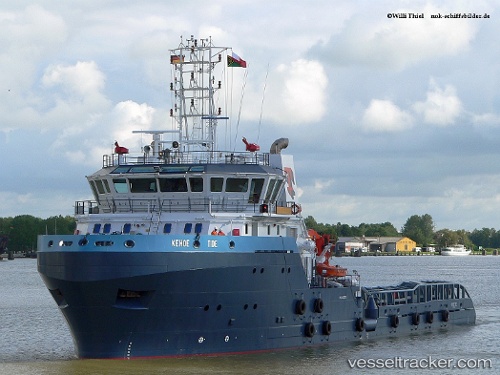
Kehoe Tide
Current StatusWhere is the vessel?
Kehoe Tide is currently in 18 nm NW of Ras Al Khair, based on AIS data received less than 1h ago.
Latest AIS update:
Current position: 27.76167° N, 48.93500° E (18 nm NW of Ras Al Khair)
Average speed (last 7 days): Loading…
Average speed (last 30 days): Loading…
Vessel profile: Kehoe Tide is a Offshore Tug Supply Ship with dimensions 14m x 70m.
This page combines live AIS, route history, probable destination signals, nearby traffic, and port activity for practical vessel monitoring.
The current position of vessel Kehoe Tide is 27.76167 lat / 48.93500 lng. Updated: 2026-04-06 09:59:02 UTCNearest reference points:
- Near Bandar Al Mishab
- Near Ras Al Khair
- Near Ras Al-Khair
Details:
Live Vessel Kehoe Tide Analytics (details, animations, etc.)
Recent AIS points (UTC):
2026-04-06 02:34:53 UTC · 27.76219, 48.93606 · SOG 0 kn · COG 335°2026-04-06 05:49:59 UTC · 27.76167, 48.93500 · SOG 0 kn · COG -1°
2026-04-06 07:56:06 UTC · 27.76167, 48.93500 · SOG 0 kn · COG -1°
2026-04-06 09:59:02 UTC · 27.76167, 48.93500 · SOG 0 kn · COG -1°