 vesseltracker.com
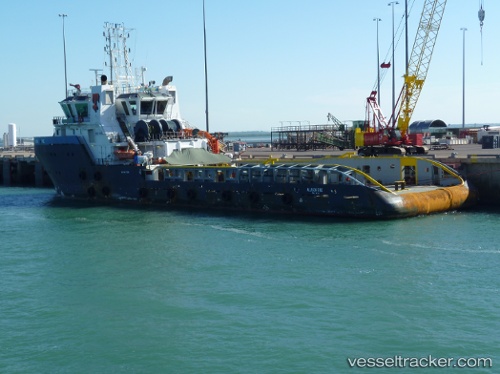
Allison Tide
Current StatusWhere is the vessel?
Allison Tide is currently in 30 nm NE of Ras Tannurah, based on AIS data received about 2h ago.
Latest AIS update:
Current position: 27.00699° N, 50.57078° E (30 nm NE of Ras Tannurah)
Average speed (last 7 days): Loading…
Average speed (last 30 days): Loading…
Vessel profile: Allison Tide is a Offshore Tug Supply Ship with dimensions 16m x 70m.
This page combines live AIS, route history, probable destination signals, nearby traffic, and port activity for practical vessel monitoring.
The current position of vessel Allison Tide is 27.00699 lat / 50.57078 lng. Updated: 2026-04-05 18:20:59 UTCNearest reference points:
- Near Ad Dammam
- Near DAMMAM
- Near Sayhat
Details:
Live Vessel Allison Tide Analytics (details, animations, etc.)
Recent AIS points (UTC):
2026-04-05 08:42:55 UTC · 27.01167, 50.57333 · SOG 0 kn · COG -1°2026-04-05 10:33:57 UTC · 27.01167, 50.57333 · SOG 0 kn · COG -1°
2026-04-05 17:40:18 UTC · 27.01278, 50.56730 · SOG 2.6 kn · COG 335°
2026-04-05 18:20:59 UTC · 27.00699, 50.57078 · SOG 3 kn · COG 154°