 vesseltracker.com
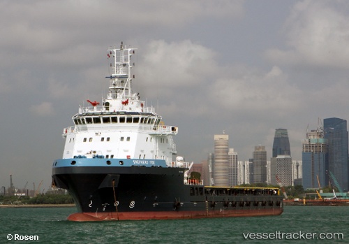
Shepherd Tide
Current StatusWhere is the vessel?
Shepherd Tide is currently in 34 nm NE of Enmore, based on AIS data received about 6h ago.
Latest AIS update:
Current position: 7.24667° N, 57.67500° W (34 nm NE of Enmore)
Average speed (last 7 days): Loading…
Average speed (last 30 days): Loading…
Vessel profile: Shepherd Tide is a Offshore Tug Supply Ship with dimensions 24m x 78m.
This page combines live AIS, route history, probable destination signals, nearby traffic, and port activity for practical vessel monitoring.
The current position of vessel Shepherd Tide is 7.24667 lat / -57.67500 lng. Updated: 2026-04-05 11:12:08 UTCNearest reference points:
- 57 nm NE of Adventure
- 38 nm NW of Jarikaba
Details:
Live Vessel Shepherd Tide Analytics (details, animations, etc.)
Recent AIS points (UTC):
2026-04-05 05:45:03 UTC · 7.53761, -57.30658 · SOG 5.2 kn · COG 196°2026-04-05 08:04:43 UTC · 7.40841, -57.46931 · SOG 5.1 kn · COG 205°
2026-04-05 09:45:11 UTC · 7.31833, -57.58167 · SOG 4 kn · COG -1°
2026-04-05 11:12:08 UTC · 7.24667, -57.67500 · SOG 1 kn · COG -1°