 vesseltracker.com
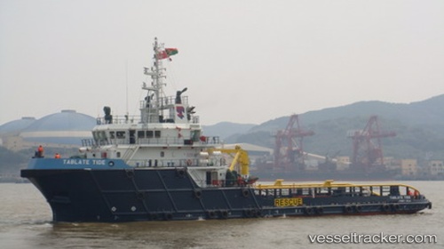
Tablate Tide
Current StatusWhere is the vessel?
Tablate Tide is currently in Near AL JUBAIL, based on AIS data received about 1h ago.
Latest AIS update:
Current position: 27.24918° N, 49.65293° E (Near AL JUBAIL)
Average speed (last 7 days): Loading…
Average speed (last 30 days): Loading…
Vessel profile: Tablate Tide is a Offshore Tug Supply Ship with dimensions 14m x 59m.
This page combines live AIS, route history, probable destination signals, nearby traffic, and port activity for practical vessel monitoring.
The current position of vessel Tablate Tide is 27.24918 lat / 49.65293 lng. Updated: 2026-04-12 19:37:59 UTCNearest reference points:
- 13 nm NE of AL JUBAIL
- Near Al Jubayl
- Near Al Jubayl Industrial City
Details:
Live Vessel Tablate Tide Analytics (details, animations, etc.)
Recent AIS points (UTC):
2026-04-12 14:00:35 UTC · 27.23286, 49.77725 · SOG 7.1 kn · COG 255°2026-04-12 15:32:06 UTC · 27.24869, 49.65272 · SOG 0.3 kn · COG 74°
2026-04-12 17:57:26 UTC · 27.24922, 49.65289 · SOG 0 kn · COG 120°
2026-04-12 19:37:59 UTC · 27.24918, 49.65293 · SOG 0 kn · COG 136°