 vesseltracker.com
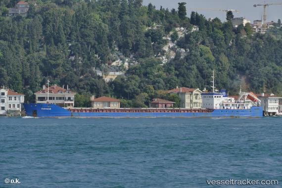
 Varnava
Current Status
Where is the vessel?
Varnava is currently in Near Varna, based on AIS data received about 1h ago.
Latest AIS update:
Current position: 43.19422° N, 27.91268° E (Near Varna)
Average speed (last 7 days): Loading…
Average speed (last 30 days): Loading…
Vessel profile: Varnava is a General Cargo Ship with dimensions 104m x 12m.
This page combines live AIS, route history, probable destination signals, nearby traffic, and port activity for practical vessel monitoring.
The current position of vessel Varnava is 43.19422 lat / 27.91268 lng. Updated: 2026-03-30 15:41:14 UTCNearest reference points:
- Near Varna
- Near Ignatievo
- Near Beloslav
Currently sailing under the flag of Vanuatu ![]()
Varnava built in 2008 year
Deadweight:
3277 tDetails:
Live Vessel Varnava Analytics (details, animations, etc.)
Recent AIS points (UTC):
2026-03-30 09:22:46 UTC · 43.19420, 27.91266 · SOG 0 kn · COG 311°2026-03-30 12:01:41 UTC · 43.19419, 27.91269 · SOG 0 kn · COG 335°
2026-03-30 14:00:22 UTC · 43.19423, 27.91268 · SOG 0 kn · COG 333°
2026-03-30 15:41:14 UTC · 43.19422, 27.91268 · SOG 0 kn · COG 328°