 vesseltracker.com
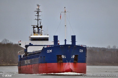
 CEMILE
Current Status
Where is the vessel?
CEMILE is currently in 17 nm E of Hydra (Idhra), based on AIS data received about 11h ago.
Latest AIS update:
Current position: 37.25500° N, 23.79833° E (17 nm E of Hydra (Idhra))
Average speed (last 7 days): Loading…
Average speed (last 30 days): Loading…
Vessel profile: CEMILE is a General Cargo Ship with dimensions 88m x 13m.
This page combines live AIS, route history, probable destination signals, nearby traffic, and port activity for practical vessel monitoring.
The current position of vessel CEMILE is 37.25500 lat / 23.79833 lng. Updated: 2026-04-10 06:57:05 UTCNearest reference points:
- Near Methana
- Near POROS
- Near Galatas Troizinas
Currently sailing under the flag of Vanuatu ![]()
CEMILE built in 1991 year
Deadweight:
4270 tDetails:
Live Vessel CEMILE Analytics (details, animations, etc.)
Recent AIS points (UTC):
2026-04-10 02:14:05 UTC · 37.26409, 23.82971 · SOG 0.2 kn · COG 222°2026-04-10 04:02:10 UTC · 37.26338, 23.82045 · SOG 0.2 kn · COG 238°
2026-04-10 05:17:11 UTC · 37.26200, 23.81242 · SOG 0.4 kn · COG 192°
2026-04-10 06:57:05 UTC · 37.25500, 23.79833 · SOG 0 kn · COG -1°