 vesseltracker.com
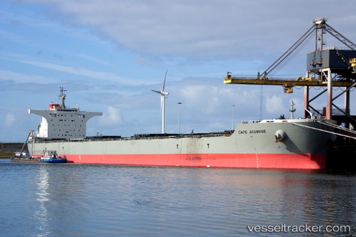
 CAPE JASMINE
Current Status
Where is the vessel?
CAPE JASMINE is currently in 16 nm SW of Pulau Jarak, based on AIS data received about 2h ago.
Latest AIS update:
Current position: 3.77667° N, 99.88667° E (16 nm SW of Pulau Jarak)
Average speed (last 7 days): Loading…
Average speed (last 30 days): Loading…
Vessel profile: CAPE JASMINE is a Bulk Carrier with dimensions 292m x 292m.
This page combines live AIS, route history, probable destination signals, nearby traffic, and port activity for practical vessel monitoring.
The current position of vessel CAPE JASMINE is 3.77667 lat / 99.88667 lng. Updated: 2026-04-19 19:36:11 UTCNearest reference points:
- 11 nm W of Pangkur
- 43 nm NE of Perbaungan
- Near PANGKOR
Currently sailing under the flag of South Africa ![]()
CAPE JASMINE built in 2012 year
Deadweight:
176330 tDetails:
Live Vessel CAPE JASMINE Analytics (details, animations, etc.)
Recent AIS points (UTC):
2026-04-19 16:18:57 UTC · 3.36678, 100.41362 · SOG 13.1 kn · COG 308°2026-04-19 18:03:11 UTC · 3.59833, 100.12833 · SOG 12 kn · COG -1°
2026-04-19 19:28:51 UTC · 3.76352, 99.90521 · SOG 11.1 kn · COG -1°
2026-04-19 19:36:11 UTC · 3.77667, 99.88667 · SOG 11 kn · COG -1°