 vesseltracker.com
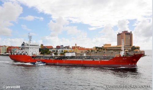
 ILITHA
Current Status
Where is the vessel?
ILITHA is currently in Near Island View, based on AIS data received less than 1h ago.
Latest AIS update:
Current position: 29.88155° S, 31.03184° E (Near Island View)
Average speed (last 7 days): Loading…
Average speed (last 30 days): Loading…
Vessel profile: ILITHA is a Tanker with dimensions m x m.
This page combines live AIS, route history, probable destination signals, nearby traffic, and port activity for practical vessel monitoring.
The current position of vessel ILITHA is -29.88155 lat / 31.03184 lng. Updated: 2026-04-17 16:27:48 UTCNearest reference points:
- Near Island View
- Near Durban
- Near Umhlanga Rocks
Currently sailing under the flag of South Africa ![]()
Details:
Live Vessel ILITHA Analytics (details, animations, etc.)
Recent AIS points (UTC):
2026-04-17 10:21:58 UTC · -29.88161, 31.03178 · SOG 0 kn · COG 74°2026-04-17 12:00:43 UTC · -29.88160, 31.03179 · SOG 0 kn · COG 73°
2026-04-17 14:03:57 UTC · -29.88163, 31.03180 · SOG 0 kn · COG 73°
2026-04-17 16:27:48 UTC · -29.88155, 31.03184 · SOG 0 kn · COG 73°