 vesseltracker.com
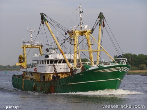
 BELA
BELA
Current Status
Where is the vessel?
BELA is currently in 256 nm NE of Sam Lords Castle, based on AIS data received about 188d ago.
Latest AIS update:
Current position: 15.68593° N, 55.92249° W (256 nm NE of Sam Lords Castle)
Average speed (last 7 days): Loading…
Average speed (last 30 days): Loading…
Vessel profile: BELA is a Fishing Vessel with dimensions 9m x 39m.
This page combines live AIS, route history, probable destination signals, nearby traffic, and port activity for practical vessel monitoring.
The current position of vessel BELA is 15.68593 lat / -55.92249 lng. Updated: 2025-09-26 03:39:53 UTCNearest reference points:
- 267 nm E of La Désirade
- Open sea, approx. 405 nm off the nearest listed port
- Open sea, approx. 404 nm off the nearest listed port
Currently sailing under the flag of Cameroon ![]()
BELA built in 1981 year
Deadweight:
0 tDetails:
Live Vessel BELA Analytics (details, animations, etc.)
Recent AIS points (UTC):
2025-09-26 03:39:53 UTC · 15.68593, -55.92249 · SOG -0.1 kn · COG 183°