 vesseltracker.com
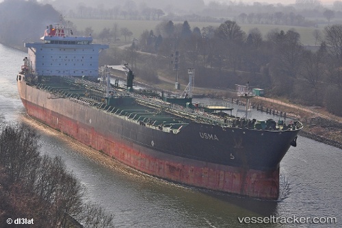
 SINAR G
Current Status
Where is the vessel?
SINAR G is currently in 18 nm S of Mesta Hiou, based on AIS data received about 1d ago.
Latest AIS update:
Current position: 38.00267° N, 25.80796° E (18 nm S of Mesta Hiou)
Average speed (last 7 days): Loading…
Average speed (last 30 days): Loading…
Vessel profile: SINAR G is a Oil/Chemical Tanker with dimensions m x m.
This page combines live AIS, route history, probable destination signals, nearby traffic, and port activity for practical vessel monitoring.
The current position of vessel SINAR G is 38.00267 lat / 25.80796 lng. Updated: 2026-04-10 07:41:50 UTCNearest reference points:
- 13 nm NW of Karkinagri Ikarias
- Near CESME
- Near MYKONOS OLD PORT
Currently sailing under the flag of Cameroon ![]()
Details:
Live Vessel SINAR G Analytics (details, animations, etc.)
Recent AIS points (UTC):
2026-04-10 02:16:59 UTC · 37.12766, 26.54923 · SOG 12.4 kn · COG 305°2026-04-10 04:02:18 UTC · 37.33080, 26.15132 · SOG 12.5 kn · COG 298°
2026-04-10 05:37:20 UTC · 37.55327, 25.87598 · SOG 13.4 kn · COG 358°
2026-04-10 07:41:50 UTC · 38.00267, 25.80796 · SOG 13.3 kn · COG 354°