 vesseltracker.com
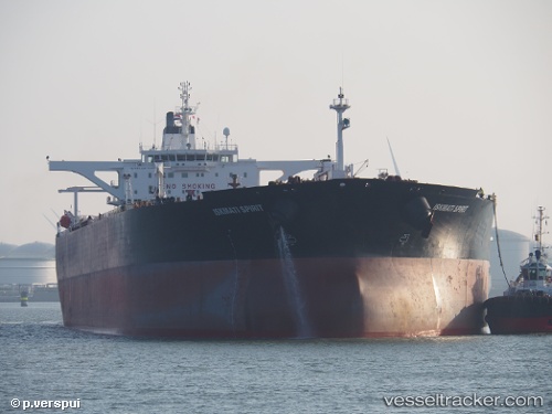
 BLUE
BLUE
Current Status
Where is the vessel?
BLUE is currently in 112 nm NW of Tinaquillo, based on AIS data received less than 1h ago.
Latest AIS update:
Current position: 10.70528° N, 66.58757° E (112 nm NW of Tinaquillo)
Average speed (last 7 days): Loading…
Average speed (last 30 days): Loading…
Vessel profile: BLUE is a Crude Oil Tanker with dimensions m x m.
This page combines live AIS, route history, probable destination signals, nearby traffic, and port activity for practical vessel monitoring.
The current position of vessel BLUE is 10.70528 lat / 66.58757 lng. Updated: 2026-04-21 22:17:59 UTCNearest reference points:
- 187 nm N of Tinaquillo
- 98 nm S of Tinaquillo
- 198 nm N of Tinaquillo
Currently sailing under the flag of Cameroon ![]()
Details:
Live Vessel BLUE Analytics (details, animations, etc.)
Recent AIS points (UTC):
2026-04-21 19:29:24 UTC · 10.47671, 67.08785 · SOG 11.5 kn · COG 296°2026-04-21 19:34:15 UTC · 10.48335, 67.07375 · SOG 11.4 kn · COG 295°
2026-04-21 21:38:09 UTC · 10.65733, 66.71267 · SOG 11.7 kn · COG 290°
2026-04-21 22:17:59 UTC · 10.70528, 66.58757 · SOG 11.8 kn · COG 292°