 vesseltracker.com
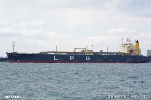
 TULIP
TULIP
Current Status
Where is the vessel?
TULIP is currently in 59 nm S of JASK, based on AIS data received about 4h ago.
Latest AIS update:
Current position: 24.70021° N, 58.08091° E (59 nm S of JASK)
Average speed (last 7 days): Loading…
Average speed (last 30 days): Loading…
Vessel profile: TULIP is a Lpg Tanker with dimensions m x m.
This page combines live AIS, route history, probable destination signals, nearby traffic, and port activity for practical vessel monitoring.
The current position of vessel TULIP is 24.70021 lat / 58.08091 lng. Updated: 2026-04-08 10:16:05 UTCNearest reference points:
- 58 nm S of JASK
- 42 nm SE of Offshore Fujairah
- 17 nm SE of JASK
Currently sailing under the flag of Cameroon ![]()
Details:
Live Vessel TULIP Analytics (details, animations, etc.)
Recent AIS points (UTC):
2026-04-08 07:30:39 UTC · 24.79513, 58.01596 · SOG 2.4 kn · COG -1°2026-04-08 09:51:05 UTC · 24.71390, 58.07207 · SOG 2.3 kn · COG 189°
2026-04-08 10:16:05 UTC · 24.70021, 58.08091 · SOG 2.2 kn · COG 184°
2026-04-08 10:16:05 UTC · 24.70021, 58.08091 · SOG 2.2 kn · COG 184°