 vesseltracker.com
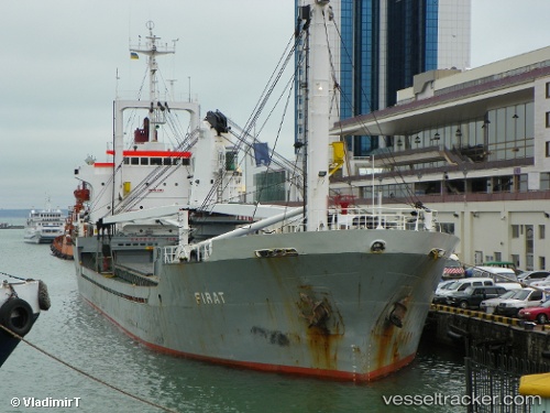
 Firat
Firat
Current Status
Where is the vessel?
Firat is currently in Near Bari, based on AIS data received less than 1h ago.
Latest AIS update:
Current position: 41.13587° N, 16.86933° E (Near Bari)
Average speed (last 7 days): Loading…
Average speed (last 30 days): Loading…
Vessel profile: Firat is a General Cargo Ship with dimensions 105m x 16m.
This page combines live AIS, route history, probable destination signals, nearby traffic, and port activity for practical vessel monitoring.
The current position of vessel Firat is 41.13587 lat / 16.86933 lng. Updated: 2026-04-18 16:21:58 UTCNearest reference points:
- Near Monopoli
- Near Marina di Ginosa
- Near Porto Di Brindisi
Currently sailing under the flag of Comoros ![]()
Firat built in 1983 year
Deadweight:
6378 tDetails:
Live Vessel Firat Analytics (details, animations, etc.)
Recent AIS points (UTC):
2026-04-18 09:45:57 UTC · 41.13586, 16.86936 · SOG 0 kn · COG -1°2026-04-18 12:18:58 UTC · 41.13582, 16.86938 · SOG 0 kn · COG -1°
2026-04-18 14:03:56 UTC · 41.13582, 16.86935 · SOG 0 kn · COG -1°
2026-04-18 16:21:58 UTC · 41.13587, 16.86933 · SOG 0.1 kn · COG -1°