 vesseltracker.com
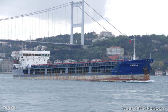
 Ommax
Ommax
Current Status
Where is the vessel?
Ommax is currently in 13 nm SW of Taman', based on AIS data received about 20h ago.
Latest AIS update:
Current position: 45.06349° N, 36.50215° E (13 nm SW of Taman')
Average speed (last 7 days): Loading…
Average speed (last 30 days): Loading…
Vessel profile: Ommax is a General Cargo Ship with dimensions 108m x 15m.
This page combines live AIS, route history, probable destination signals, nearby traffic, and port activity for practical vessel monitoring.
The current position of vessel Ommax is 45.06349 lat / 36.50215 lng. Updated: 2026-03-26 07:45:51 UTCNearest reference points:
- 13 nm SW of Taman'
- 11 nm SW of Taman'
- 14 nm SW of Taman'
Currently sailing under the flag of Comoros ![]()
Ommax built in 2010 year
Deadweight:
3662 tDetails:
Live Vessel Ommax Analytics (details, animations, etc.)
Recent AIS points (UTC):
2026-03-26 05:50:42 UTC · 45.13605, 36.50051 · SOG 2 kn · COG -1°2026-03-26 07:35:50 UTC · 45.07162, 36.50246 · SOG 7.9 kn · COG -1°
2026-03-26 07:45:51 UTC · 45.06349, 36.50215 · SOG 7.9 kn · COG -1°
2026-03-26 07:45:51 UTC · 45.06349, 36.50215 · SOG 7.9 kn · COG -1°