 vesseltracker.com
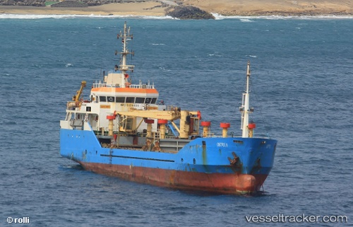
 Ostrea
Current Status
Where is the vessel?
Ostrea is currently in Near Mindelo, based on AIS data received less than 1h ago.
Latest AIS update:
Current position: 16.88956° N, 24.99822° W (Near Mindelo)
Average speed (last 7 days): Loading…
Average speed (last 30 days): Loading…
Vessel profile: Ostrea is a General Cargo Ship with dimensions 70m x 11m.
This page combines live AIS, route history, probable destination signals, nearby traffic, and port activity for practical vessel monitoring.
The current position of vessel Ostrea is 16.88956 lat / -24.99822 lng. Updated: 2026-04-19 12:09:50 UTCNearest reference points:
- 39 nm W of Ilha do Sal
- 100 nm N of Porto Grande
- 102 nm N of Porto Grande
Currently sailing under the flag of Cape Verde ![]()
Details:
Live Vessel Ostrea Analytics (details, animations, etc.)
Recent AIS points (UTC):
2026-04-19 07:36:48 UTC · 16.88954, -24.99821 · SOG 0 kn · COG 20°2026-04-19 09:45:48 UTC · 16.88956, -24.99823 · SOG 0 kn · COG 20°
2026-04-19 10:24:50 UTC · 16.88958, -24.99821 · SOG 0 kn · COG 19°
2026-04-19 12:09:50 UTC · 16.88956, -24.99822 · SOG 0 kn · COG 20°