 vesseltracker.com
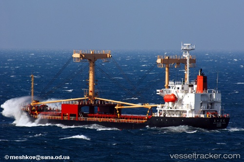
 ABRAHAM A
Current Status
Where is the vessel?
ABRAHAM A is currently in 47 nm SW of Al Muajjiz, based on AIS data received about 1h ago.
Latest AIS update:
Current position: 22.76060° N, 38.00155° E (47 nm SW of Al Muajjiz)
Average speed (last 7 days): Loading…
Average speed (last 30 days): Loading…
Vessel profile: ABRAHAM A is a General Cargo with dimensions m x m.
This page combines live AIS, route history, probable destination signals, nearby traffic, and port activity for practical vessel monitoring.
The current position of vessel ABRAHAM A is 22.76060 lat / 38.00155 lng. Updated: 2026-03-31 08:11:30 UTCNearest reference points:
- 65 nm SW of King Abdullah City
- 67 nm W of Tusdeer Free Zone
- Near Rabigh
Currently sailing under the flag of Comoros ![]()
Details:
Live Vessel ABRAHAM A Analytics (details, animations, etc.)
Recent AIS points (UTC):
2026-03-31 02:26:28 UTC · 22.85656, 37.93877 · SOG 1 kn · COG 231°2026-03-31 03:26:29 UTC · 22.83965, 37.94858 · SOG 1.3 kn · COG 230°
2026-03-31 05:41:23 UTC · 22.80041, 37.97342 · SOG 1.2 kn · COG 242°
2026-03-31 08:11:30 UTC · 22.76060, 38.00155 · SOG 1.1 kn · COG 213°