 vesseltracker.com
 ROZ Y
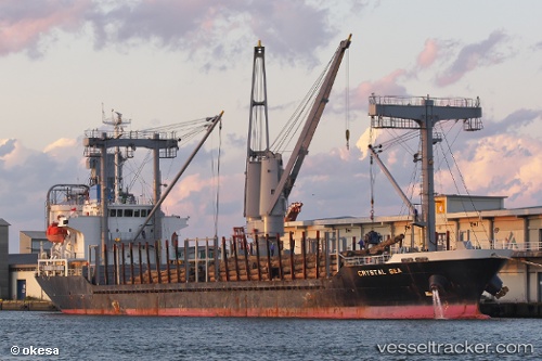
ROZ Y
Current Status
Where is the vessel?
ROZ Y is currently in Near Agigea, based on AIS data received less than 1h ago.
Latest AIS update:
Current position: 44.09490° N, 28.64275° E (Near Agigea)
Average speed (last 7 days): Loading…
Average speed (last 30 days): Loading…
Vessel profile: ROZ Y is a General Cargo with dimensions m x m.
This page combines live AIS, route history, probable destination signals, nearby traffic, and port activity for practical vessel monitoring.
The current position of vessel ROZ Y is 44.09490 lat / 28.64275 lng. Updated: 2026-04-12 09:21:23 UTCNearest reference points:
- Near Constanta
- Near Ovidiu
- Near MIDIA
Currently sailing under the flag of Comoros ![]()
Details:
Live Vessel ROZ Y Analytics (details, animations, etc.)
Recent AIS points (UTC):
2026-04-10 07:43:18 UTC · 44.09890, 28.64597 · SOG 3.8 kn · COG 187°2026-04-12 06:29:43 UTC · 44.09478, 28.64298 · SOG 0 kn · COG 332°
2026-04-12 07:56:44 UTC · 44.09503, 28.64303 · SOG 0 kn · COG 332°
2026-04-12 09:21:23 UTC · 44.09490, 28.64275 · SOG 0.1 kn · COG 332°