 vesseltracker.com
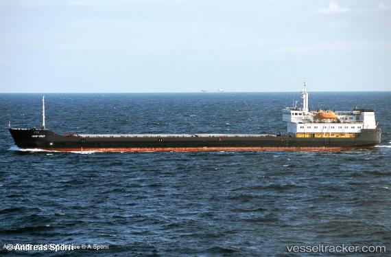
 ATLANTIS
Current Status
Where is the vessel?
ATLANTIS is currently in Near Saraylar, based on AIS data received about 1h ago.
Latest AIS update:
Current position: 40.66723° N, 27.64660° E (Near Saraylar)
Average speed (last 7 days): Loading…
Average speed (last 30 days): Loading…
Vessel profile: ATLANTIS is a General Cargo with dimensions m x m.
This page combines live AIS, route history, probable destination signals, nearby traffic, and port activity for practical vessel monitoring.
The current position of vessel ATLANTIS is 40.66723 lat / 27.64660 lng. Updated: 2026-04-18 06:07:16 UTCNearest reference points:
- Near Saraylar
- Near Marmara Adasi
- Near Erdek
Currently sailing under the flag of Comoros ![]()
Details:
Live Vessel ATLANTIS Analytics (details, animations, etc.)
Recent AIS points (UTC):
2026-04-17 23:54:39 UTC · 40.66744, 27.64642 · SOG 0 kn · COG 51°2026-04-18 01:48:39 UTC · 40.66737, 27.64644 · SOG 0 kn · COG 45°
2026-04-18 03:57:43 UTC · 40.66741, 27.64643 · SOG 0 kn · COG 50°
2026-04-18 06:07:16 UTC · 40.66723, 27.64660 · SOG 0 kn · COG -1°