 vesseltracker.com
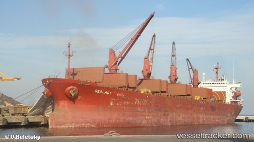
 SEA MERAY
Current Status
Where is the vessel?
SEA MERAY is currently in 54 nm NW of EREN, based on AIS data received about 1d ago.
Latest AIS update:
Current position: 42.24426° N, 31.16657° E (54 nm NW of EREN)
Average speed (last 7 days): Loading…
Average speed (last 30 days): Loading…
Vessel profile: SEA MERAY is a Bulk Carrier with dimensions m x m.
This page combines live AIS, route history, probable destination signals, nearby traffic, and port activity for practical vessel monitoring.
The current position of vessel SEA MERAY is 42.24426 lat / 31.16657 lng. Updated: 2026-04-18 04:32:53 UTCNearest reference points:
- Near Erdemir
- 45 nm N of RUMELI FENERI
- 54 nm SE of Sveti Nikola
Currently sailing under the flag of Guinea ![]()
Details:
Live Vessel SEA MERAY Analytics (details, animations, etc.)
Recent AIS points (UTC):
2026-04-18 03:57:55 UTC · 42.18856, 31.05061 · SOG 10.5 kn · COG 54°2026-04-18 04:32:53 UTC · 42.24426, 31.16657 · SOG 10.4 kn · COG 52°
2026-04-18 04:32:53 UTC · 42.24426, 31.16657 · SOG 10.4 kn · COG 52°
2026-04-18 04:32:53 UTC · 42.24426, 31.16657 · SOG 10.4 kn · COG 52°