 vesseltracker.com
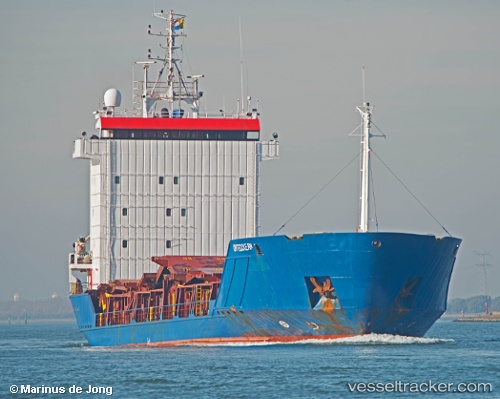
 SEABURG 1
Current Status
Where is the vessel?
SEABURG 1 is currently in 37 nm N of Pinelands, based on AIS data received about 1h ago.
Latest AIS update:
Current position: 34.53119° N, 18.50889° E (37 nm N of Pinelands)
Average speed (last 7 days): Loading…
Average speed (last 30 days): Loading…
Vessel profile: SEABURG 1 is a General Cargo with dimensions m x m.
This page combines live AIS, route history, probable destination signals, nearby traffic, and port activity for practical vessel monitoring.
The current position of vessel SEABURG 1 is 34.53119 lat / 18.50889 lng. Updated: 2026-04-19 06:43:54 UTCNearest reference points:
- 71 nm N of Pinelands
- 73 nm N of Pinelands
- 60 nm S of Pinelands
Currently sailing under the flag of Guinea ![]()
Details:
Live Vessel SEABURG 1 Analytics (details, animations, etc.)
Recent AIS points (UTC):
2026-04-19 00:39:55 UTC · 34.95633, 19.43848 · SOG 7.7 kn · COG 246°2026-04-19 03:27:51 UTC · 34.77348, 18.99055 · SOG 8.5 kn · COG 238°
2026-04-19 03:27:51 UTC · 34.77348, 18.99055 · SOG 8.5 kn · COG 238°
2026-04-19 06:43:54 UTC · 34.53119, 18.50889 · SOG 8.3 kn · COG 237°