 vesseltracker.com
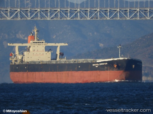
Baosteel Expedition
Current StatusWhere is the vessel?
Baosteel Expedition is currently in 344 nm E of Levelwood, based on AIS data received less than 1h ago.
Latest AIS update:
Current position: 13.76080° S, 0.05983° E (344 nm E of Levelwood)
Average speed (last 7 days): Loading…
Average speed (last 30 days): Loading…
Vessel profile: Baosteel Expedition is a Ore Carrier with dimensions 50m x 300m.
This page combines live AIS, route history, probable destination signals, nearby traffic, and port activity for practical vessel monitoring.
The current position of vessel Baosteel Expedition is -13.76080 lat / 0.05983 lng. Updated: 2026-04-10 04:19:00 UTCNearest reference points:
- Open sea, approx. 400 nm off the nearest listed port
- Open sea, approx. 403 nm off the nearest listed port
- Open sea, approx. 401 nm off the nearest listed port
Details:
Live Vessel Baosteel Expedition Analytics (details, animations, etc.)
Recent AIS points (UTC):
2026-04-10 00:15:22 UTC · -14.44139, 0.56579 · SOG 12.5 kn · COG 323°2026-04-10 02:26:59 UTC · -14.07198, 0.29135 · SOG 12.3 kn · COG 324°
2026-04-10 03:41:19 UTC · -13.86399, 0.13956 · SOG 12.3 kn · COG 323°
2026-04-10 04:19:00 UTC · -13.76080, 0.05983 · SOG 12.2 kn · COG 323°