 vesseltracker.com
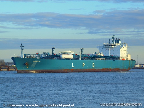
 George N
Current Status
Where is the vessel?
George N is currently in 107 nm W of Nedroma, based on AIS data received less than 1h ago.
Latest AIS update:
Current position: 34.81660° N, 16.82275° W (107 nm W of Nedroma)
Average speed (last 7 days): Loading…
Average speed (last 30 days): Loading…
Vessel profile: George N is a Lpg Tanker with dimensions 205m x 205m.
This page combines live AIS, route history, probable destination signals, nearby traffic, and port activity for practical vessel monitoring.
The current position of vessel George N is 34.81660 lat / -16.82275 lng. Updated: 2026-04-09 19:10:23 UTCNearest reference points:
- 78 nm W of Nedroma
- 150 nm NW of Ponta do Pargo
Currently sailing under the flag of Liberia ![]()
George N built in 2008 year
Deadweight:
43601 tDetails:
Live Vessel George N Analytics (details, animations, etc.)
Recent AIS points (UTC):
2026-04-09 13:46:52 UTC · 34.81911, -18.23954 · SOG 12.4 kn · COG 87°2026-04-09 14:54:12 UTC · 34.82209, -17.95351 · SOG 12.6 kn · COG 88°
2026-04-09 18:06:46 UTC · 34.83306, -17.10817 · SOG 13.1 kn · COG 90°
2026-04-09 19:10:23 UTC · 34.81660, -16.82275 · SOG 13.4 kn · COG 94°