 vesseltracker.com
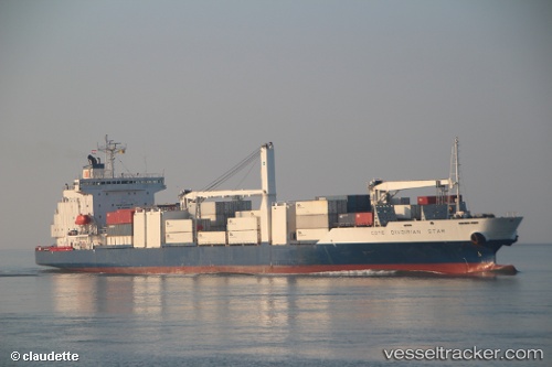
 Cote D Ivoirian Star
Current Status
Where is the vessel?
Cote D Ivoirian Star is currently in Near Douala, based on AIS data received less than 1h ago.
Latest AIS update:
Current position: 3.94772° N, 9.57565° E (Near Douala)
Average speed (last 7 days): Loading…
Average speed (last 30 days): Loading…
Vessel profile: Cote D Ivoirian Star is a Refrigerated Cargo Ship with dimensions 185m x 24m.
This page combines live AIS, route history, probable destination signals, nearby traffic, and port activity for practical vessel monitoring.
The current position of vessel Cote D Ivoirian Star is 3.94772 lat / 9.57565 lng. Updated: 2026-04-21 19:52:42 UTCNearest reference points:
- Near Victoria
- Near Moudi Terminal
- Near Calabar
Currently sailing under the flag of Liberia ![]()
Cote D Ivoirian Star built in 1998 year
Deadweight:
10350 tDetails:
Live Vessel Cote D Ivoirian Star Analytics (details, animations, etc.)
Recent AIS points (UTC):
2026-04-21 15:30:45 UTC · 4.04539, 9.68284 · SOG 0 kn · COG 55°2026-04-21 16:21:44 UTC · 4.04541, 9.68282 · SOG 0 kn · COG 55°
2026-04-21 17:56:57 UTC · 4.04500, 9.68167 · SOG 0 kn · COG -1°
2026-04-21 19:52:42 UTC · 3.94772, 9.57565 · SOG 6.1 kn · COG 221°